Planning a Guatemala road trip requires a different kind of thinking than most destinations. The country packs lowland jungle, volcanic highland passes, Caribbean coast, and Pacific shoreline into an area roughly the size of Tennessee — and the weather shifts dramatically depending on where your wheels take you that day.
Before you pick up your rental car at La Aurora International Airport and head for the open road, here are the answers to the questions that catch most first-time drivers off guard.
Does altitude actually matter for a driving trip?
Yes — more than most visitors expect. Guatemala City sits at around 1,500 meters (4,900 feet). Antigua is close behind at roughly 1,530 meters (5,020 feet). Lake Atitlán hovers near 1,562 meters (5,125 feet), and Quetzaltenango (Xela) climbs to about 2,330 meters (7,640 feet) — well over a mile above sea level.
For most sightseeing, altitude won't sideline you. But it does affect energy levels, especially in the first day or two after arriving from sea level. Expect to tire faster than usual, feel slightly short of breath on uphill walks, and sleep more lightly the first couple of nights in the highlands. Drink water consistently, ease off alcohol for the first 24 hours, and give your body a day to settle before attempting anything strenuous.
Severe altitude sickness — the kind that requires immediate descent — is uncommon at the elevations most road-trippers hit. Xela is the threshold where sensitive travelers occasionally feel it more acutely, since it sits well above the 2,500-meter mark where symptoms become more common. If you wake up with a pounding headache and nausea that doesn't ease by midday, dropping elevation is the right call.
What are the two seasons, and when should I plan my road trip?
Guatemala runs on two seasons with no real in-between.
The dry season runs from November through April. Skies are mostly clear, roads are at their most reliable, and the highland views — volcanoes against blue sky — tend to be their sharpest. This is peak travel time, which also means more company at the popular stops.
The rainy season runs from May through October. Afternoons bring heavy showers in the highlands, which clear quickly but can leave secondary roads muddy and occasionally impassable. A roughly two-week break called the canícula usually falls in late July or August, offering a brief dry window within the wet season. September and October carry the highest risk of tropical storms affecting road conditions, particularly on lowland routes.
Both seasons have their appeal. The dry season is the safer choice for mountain roads. If you're visiting in the rainy season, plan highland driving for mornings and expect delays on rural routes. The ASISTUR tourist travel recommendations from Guatemala's Tourism Board offer additional practical guidance on planning travel around seasonal conditions.
How much does the climate change between destinations?
Dramatically — sometimes within the same drive. Guatemala's three climate zones — tropical lowlands, temperate highlands, and cool upper elevations — can all show up on a single itinerary.
The highlands (Guatemala City, Antigua, Xela, Lake Atitlán) hold mild, spring-like temperatures year-round. Daytime highs typically sit between 18–24°C (65–75°F), with evenings dropping to 4–13°C (40–55°F) depending on the season and elevation. Xela runs noticeably colder than Antigua — fleece-and-jacket territory at night, especially from November through January.
Drop down into the lowlands and the climate flips entirely. Río Dulce, Livingston, and the Petén region where Tikal sits run hot and humid, with daytime temperatures regularly hitting 27–32°C (80–90°F) and humidity that makes the air feel thick. The Pacific coast matches this profile.
One road trip can take you through multiple climate zones in a single day. The drive from Xela to the Pacific coast, for example, descends more than 2,000 meters in altitude over a relatively short distance — and you'll feel every degree of the change.
What should I pack for the changing weather?
Layers are the answer, and they're non-negotiable.
Mornings in the highlands start cool, midday warms up, evenings chill back down — sometimes all in the same location. A packing strategy built around layering handles this better than bulky clothing choices.
For the highlands:
- A fleece or mid-weight jacket for mornings and evenings
- A lightweight rain jacket that packs small (useful in both seasons)
- Long pants for cooler evenings — jeans work but dry slowly; lighter travel pants are a better call
- Comfortable walking shoes with good grip for cobblestone streets
- A sweater or base layer for Xela and high-elevation nights, particularly November through February
For the lowlands and coast:
- Shorts, light shirts, and breathable fabrics
- Swimwear if you're heading to Semuc Champey, the Pacific coast beaches, or Río Dulce
- Sandals for beach days, plus closed shoes for anywhere with uneven ground
Regardless of the season, bring sunscreen. UV intensity is high at altitude, and Guatemala's highland sun is stronger than it looks. The right vehicle for your itinerary also matters — if you're dropping from the highlands to the coast and back in the same trip, something with reliable air conditioning makes the lowland stretches much more comfortable.
Are there road conditions I should anticipate at higher elevations?
A few things worth knowing before you drive into the mountains.
The Inter-American Highway (CA-1) that takes you through the western highlands is paved but includes winding sections with limited guardrails and stretches where two vehicles barely fit side by side. Treat elevation gain as a signal to slow down, particularly on unfamiliar descents.
Fog is common in the highlands, especially early morning and late afternoon. The stretch between Chimaltenango and Sololá — and the descent into Panajachel — can sock in without much warning. Low beams (not high beams, which reflect off fog and reduce visibility), reduced speed, and extra following distance are the right moves. If it becomes genuinely unsafe, pull off where the shoulder allows and wait it out.
During the rainy season, watch for standing water on mountain roads and mud on any unpaved sections. Secondary roads to some highland villages can deteriorate significantly after heavy rain. Reviewing the ASISTUR safety recommendations for highland travel before heading into the mountains is time well spent.
Checking your vehicle before heading into the mountains is always worth a few minutes. Confirm your rental's specifications and note the spare location before leaving the city.
Do I need to worry about altitude when driving, not just hiking?
The driving itself won't be affected by altitude. Your engine might — older vehicles can lose some power at high elevation due to thinner air — but modern rental cars handle Guatemala's highlands without issue.
What altitude does affect is your own reaction time and concentration, particularly if you've just arrived from sea level and haven't had a full night's sleep. Fatigue hits faster at elevation. That's a practical reason to avoid pushing through long highland drives on your first day in the country.
Take it at a sensible pace. Guatemala's highland roads reward patience more than speed.
What should I keep in the car throughout the trip?
A few practical items make a real difference across the elevation swings of a Guatemalan road trip:
- Water: Hydration matters more at altitude than at sea level. Keep bottles in the car and refill them consistently.
- A warm layer: Reachable without digging through luggage. Temperatures at high passes can drop faster than expected.
- A rain jacket: Even in the dry season, unexpected afternoon showers pass through highland areas.
- Cash in quetzales: Fuel stations, parking, and many roadside stops in rural Guatemala are cash-only.
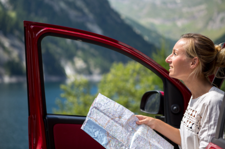
- A paper map or downloaded offline map: Cell signal thins out in mountain stretches and parts of Petén. GPS apps that require data connection can go blank exactly when you need them.
If you have questions about routes, road conditions, or what vehicle makes sense for your itinerary, the Enterprise Guatemala team is available via phone, email, and WhatsApp. Reaching out before you drive — rather than after something goes sideways — is always the better call.
What do I do if I need help on the road?
ASISTUR, Guatemala's tourist assistance program, is reachable by dialing 1500 from any Guatemalan phone, or via WhatsApp at +502 5188-1819. The line runs 24 hours a day with Spanish and English speakers and handles everything from medical referrals to roadside emergencies.
For Enterprise Guatemala rentals specifically, contact customer service at reservations@enterprise.gt or by calling +502 2217-2100. In the event of an accident, do not move the vehicle until an insurance inspector and/or police officer arrives and clears the scene — moving it beforehand can affect insurance claims and fault determination.


.png)